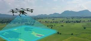
The Andhra Pradesh government has launched integrated land survey under YSR Jagananna Permanent Land Protection Scheme.
The survey would cover over 1.26 lakh square kilometres of land across the state, said Siddhartha Jain, commissioner, State Survey Settlement and Land Records.
The integrated survey would cover all categories of land including agriculture, non-agriculture, urban and rural habitations. The survey would be done in hybrid methodology using drones, CORS network and GNSS receivers, said the commissioner. The work process was presented to the judicial preview commission for scrutiny, said Siddhartha Jain.
He said that the work would require hiring of drone and aerial photography as end-to-end solution for the largescale mapping of agriculture and residential land based on the extent owned by every individual. The survey is also part of the central government’s programme of Survey of Villages Abadi and Mapping with Improvised Technology In Village Areas (SAVAMITA), he said.
The commissioner requested stakeholders to give their advice or remarks or objections to the judicial preview committee before September 7. He asked the people concerned to check the project details on the judicial preview committee’s portal.
Stakeholders can give their advice to the judicial preview committee before September 7. People may check the project details on the judicial preview committee’s portal.

